.svg)

Subscribe to our newsletter and keep up to date with urbirun news, new destinations and exclusive routes.
Join de urbirun newsletter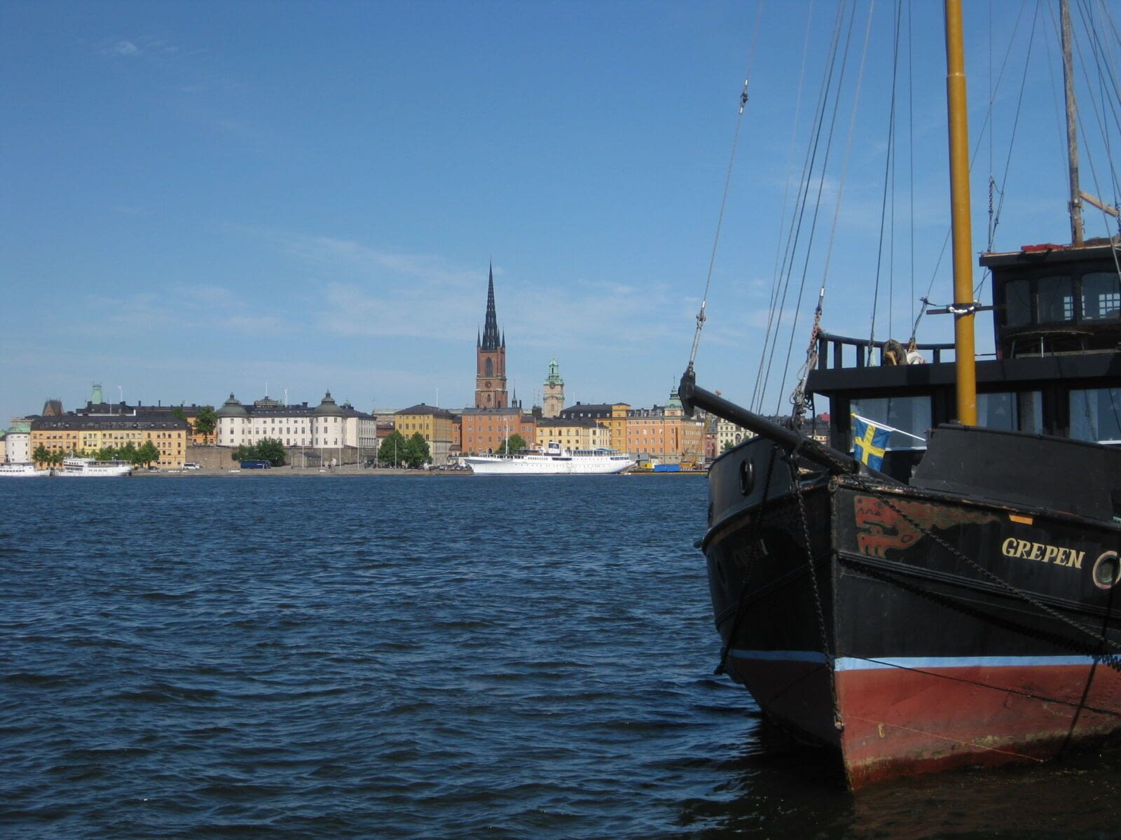
Running in Stockholm - Highlights
Stockholm, distance: 11.75km
Distance
9.25km (5.75mi) short route, without Djugarden / *11.75 (7.3mi) standard route (map) / *16.15km (10.05mi) long route, with long part in Djugarden
Altitude
low
Direction
Clockwise
Park / pedestrian
ca 6km, 50% (standard route)
Urban constraints
low
Proposed start
Sôdermalmstorg (Södermalm square)
Public transports
Bus, Stations Räntmästartrappan ou Slüssen T-Bana
Proposed start
Sôdermalmstorg (Södermalm square)
Like all urbirun routes, you can start wherever you like. Pay attention to the direction of the tour.
Run in Stockholm - Highlights
Stockholm's essentials, islands and points of view, the maze of the old city and the narrowest street in Sweden, without forgetting the green and quiet Djurgarden island, this route will introduce you to the charms of this trendy and welcoming capital, where the art of good living in harmony with oneself, with others and with nature, seems to be a true philosophy ... Let the charm act...
*Alternative routes : you can run the shortest the route if you don't cross Djugarden Bridge and turn right, before the bridge.
You can also add 4.4km (total 16.15km) to the standard route (all pedestrian in Djugarden park), if you turn left before Djugarden Bridge, and then follow the canal to the 1st bridge. And of course urbirun will guide you, no worries. Pick up the option you prefer
Bonus
Some other different runs are available to run and explore the city, as self-audioguided running-tours, that you can find on this website, or as .gpx files. Don't miss the urbirun gpx routes boutique.
Find all Urbirun routes in GPX format in the Urbirun GPX boutique!
Tour preview


Our tours
Other exclusive tours