Subscribe to our newsletter and keep up to date with urbirun news, new destinations and exclusive routes.
Join de urbirun newsletterStage 4 – Pfäffikon-Unterägeri – 32km (total 121.45km) / 892m D+ (3'274m) – 8 bridges (27)
The one where I changed route, but I didn’t enter the convent…
All you want to know about the swiss.crossing Lake2Lake adventure, is here.
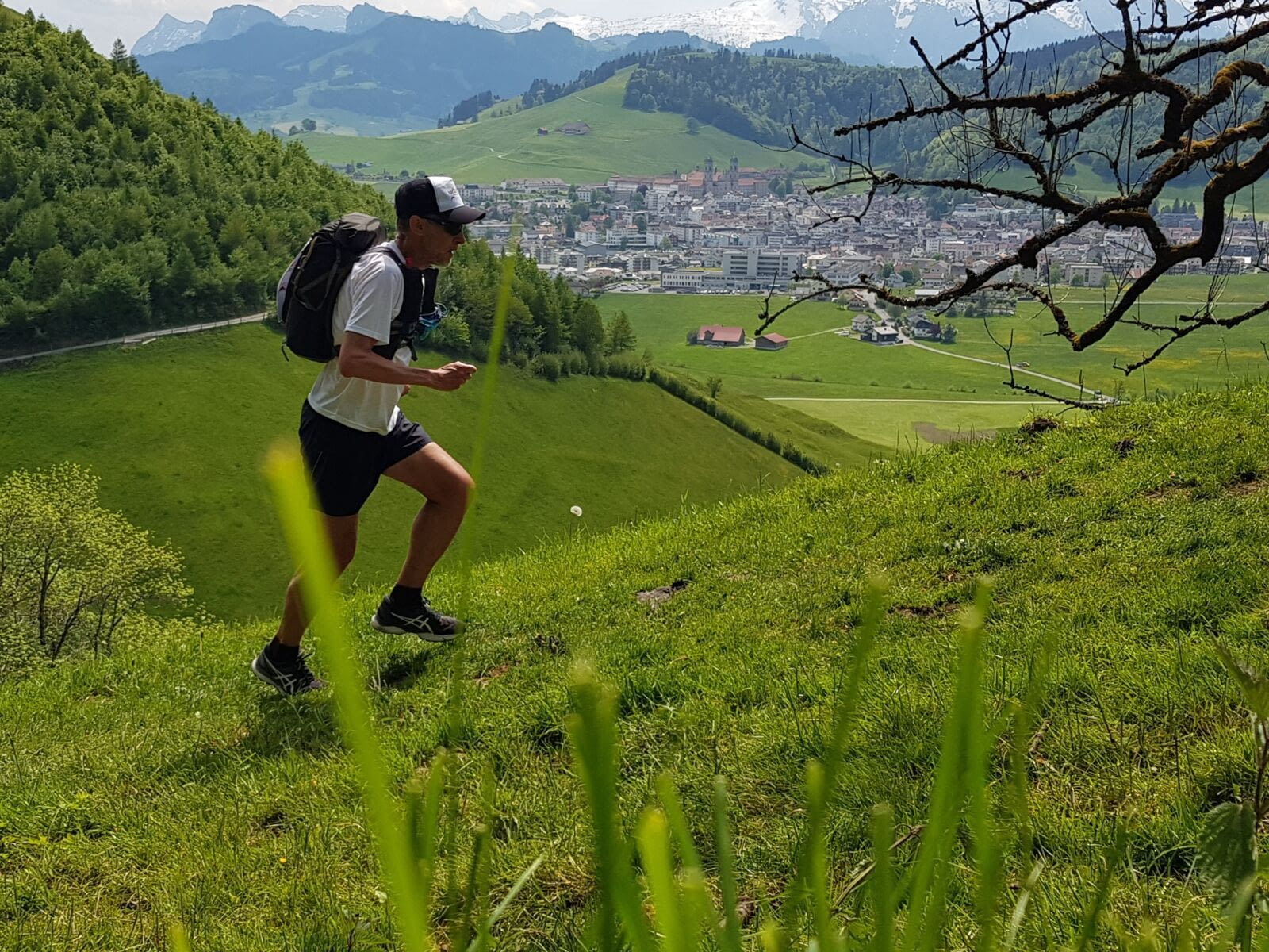
The mornings follow one another and look the same. Fortunately for the weather, a little less for the first climbs.
Km 1 to 4
Climb to the Etzelpass. More than half of the day’s elevation is here…
Hard at the beginning, the legs hurt a bit. After 1 km, just before entering the forest, I don’t forget to turn around to have a last look at the Lake of Zurich, and its islands, and in the background, the towers of the old town and castle of Rapperswil.
The ascent in the forest is not very smooth, it’s steep, there are a lot of roots, but at least it goes up fast, even if it doesn’t make big mileage.
On the small Etzel Pass, a little chapel with a bulbous bell tower, and a massive restaurant.
Km 5 to 10
It’s a steep descent (normal after a pass), on a narrow asphalt road, in the middle of the Schwyz alpine pastures. The few farms are a bit different from the St. Gallen and Appenzell farms I saw before. Much smaller, narrower and with pointed (sharpier) roofs, laminated with boards laid vertically. No particular decoration.
It goes down as steeply as it went up, and I arrive at a nice stone bridge, entirely covered in wood, which crosses the Sihl River at Büel.
Of course directly after that it goes up again, and I end up on a small flat spot, still in the meadows, and this peaceful atmosphere, slightly overlooking the Sihl lake that stretches out on my left. Created by a dam on the course of the river of the same name, it is the largest artificial lake in Switzerland, and the breaking of the 33m dam that holds its waters back, would flood Zurich.
I am surprised to already see Einsiedeln stil 3–2km away, and the 2 bell towers of its convent. The closer I get, the more imposing the convent is, the white buildings that make it up are gigantic, one can see hundreds of windows.
I make a pause in front of the convent, and I am greeted by a guy, who asks me what I do. Indeed he has already seen me passing yesterday, I would have passed him shortly before Rapperswil. He has also walked from the vicinity of Lake Constance, and Einsiedeln is his final destination.
The Benedictine monastery is over a thousand years old. This site with its “Black Madonna” has been one of the most important pilgrimage sites in Europe since the Middle Ages, and that’s why the Way of St. James (on which I have been running since the beginning) passes here.
In front of the abbey stands the Marienbrunnen (Mary’s Fountain) – also called Fraubrunnen – at about the place where a fountain stood since the foundation of the monastery. The present fountain dates from 1752 and supports a statue of Mary the Immaculate. Pilgrims traditionally like to take a sip of water from the 14 pipes. I will be satisfied with only one, to fill my flask.
Km 10 to 17
Einsiedeln also serves as a switchback, since I leave Via 4, to follow Via 3 from now on.
And it starts directly with a climb, where I struggle quite a bit, my break in Einsiedeln having probably been a bit long. I climb up to Chatzenstrich 1'054m, partly on a path broken by cows. Then it goes down again with a pleasant slope, through the alpine meadows, to the Rothenturm Alpine Marshes Nature Reserve… a big plain in which I am strangely struggling… it’s time to have a break and some food.
It was a good idea to take a few extra slices of bread this morning at breakfast, because the 2 restaurants I was hoping to stop at were closed. I stop on a bench in the middle of the marshes, after 17km. A few bread and meat leftovers from yesterday… (note for later: take a picnic and don’t count on “the path”).
I also run out of water… I hope to fill up at the next farm.
Km18 to 25
Again it is hard to start after the break, even if it is still flat through this plain. But I now know that it will pass, it is always very hard for 1–2km after the breaks…
I “steal” 5dl of water in a farm near Rothenturm, then I start the Morgarten climb. The cow paths are totally broken, I’m glad it’s dry: last week I would have left my sneakers there, sucked up by the mud and the dung.
I cross the ridge at Chli Morgarten, 1'069m, pass in the middle of a herd of cows squatting on the path, and here I am in the canton of Zug.
And it goes down again. Steep and fast, on a paved road. Beautiful views on the Aegeri lake, and at the very end, my destination.
At the edge of the lake, I go to the monument of the battle of Morgarten where I have another break, listening to a signpost that tells me the history of this battle, very iconic for swiss history (in 1315).
Km 25 to 32
7 km to go, along the south shore of the lake. It’s flat and pleasant, but I’m tired and I’m happy to arrive. This lake seems to be a popular holiday resort, campsites, second homes, line its shores. It is true that the setting is nice.
Arrived at Unterägeri, at the hotel, bad surprise: I have to go and get the key and check-in at the “mother” hotel more than 1km from there… I really don’t have the courage to run that, and I manage to borrow a bike from a passer-by who settles on a terrace… very nice and practical, and it’s true that it’s faster…
Lazy has to walk to find pastas… so aperitif and junkfood at the bar next door… it’s not the best way to refuel as there’s almost a marathon tomorrow… But I don’t mind…
Previous stage 3/12 Next stage 5/12

