Subscribe to our newsletter and keep up to date with urbirun news, new destinations and exclusive routes.
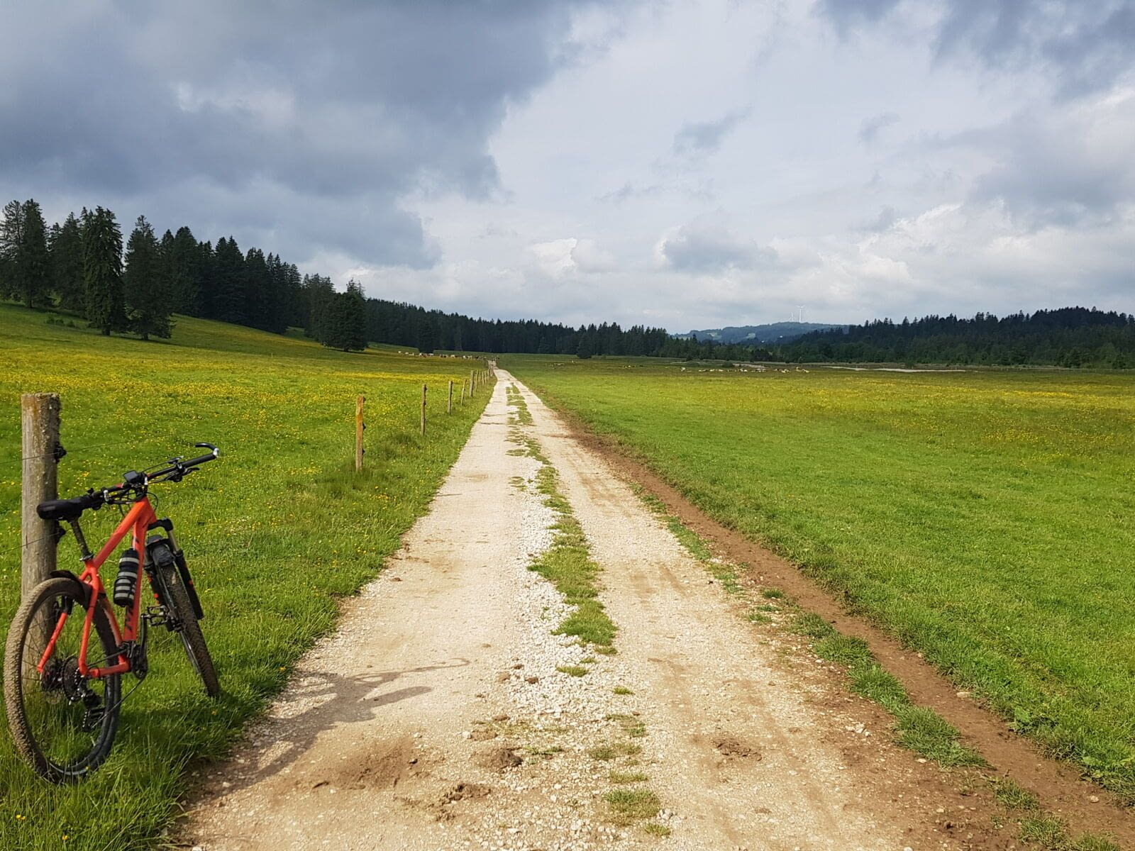
Join de urbirun newsletterMountain biking all along the Swiss Jura, on a marked, fun and varied itinerary, in the heart of lush, wild and magical landscapes. The perfect experience to clear your mind and body, but get covered in sweat and mud.
375km out of time and out of the world…
_________
Watch a short 3min video of this trip, link below.
Day-by-day details below.
“The Jura Range on a mountain bike? Well, it’s not the Alps either…”
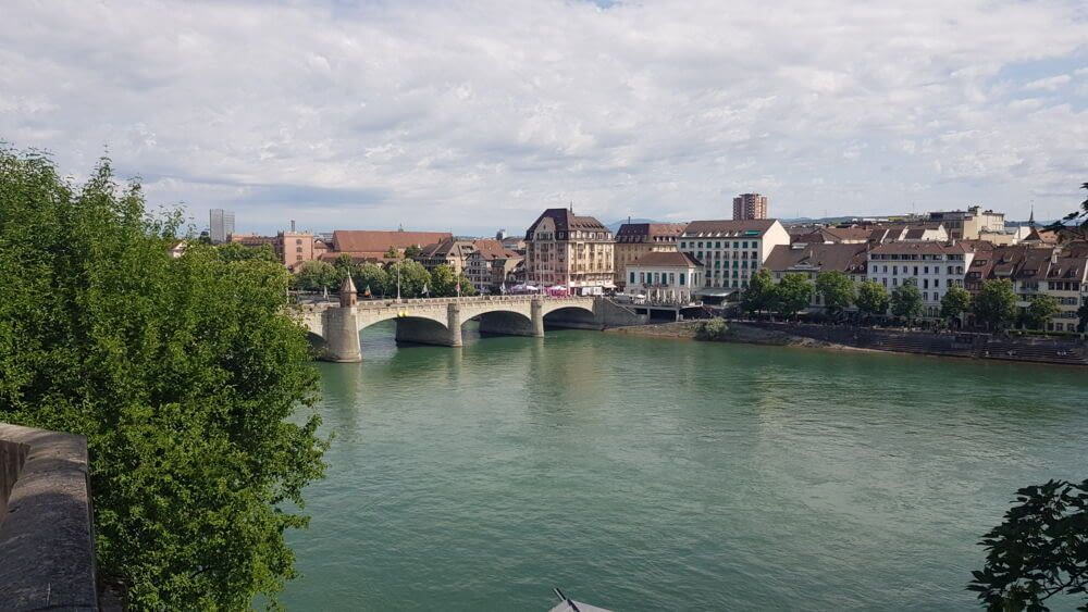
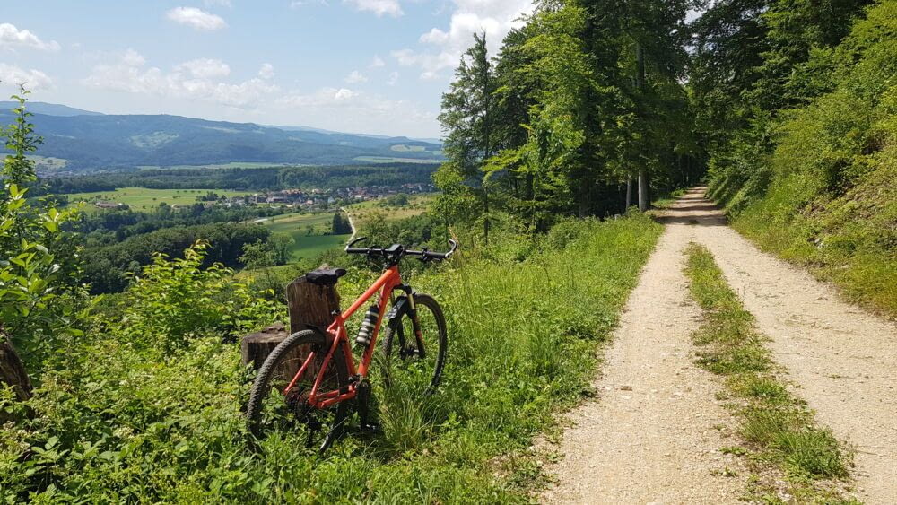
Maybe… but you’ll very soon experience that it’s a real mountain range, climbing wooded slopes that then open onto the panorama of the Birstal (Birse Valley). The Rhine, Basel, with its glowing town hall, and the surrounding vegetable plains are already behind you.
The little old town of Laufen is guarded by two imposing gates, and is perfect for a well-deserved break. A short respite before several climbs to cross the “language border”, the famous “Röstigraben” (as Switzerland has 4 languages). And now you are in French-speaking Switzerland, surrounded by forest and mountainside. The terrain is varied, as are the views. And you have a pleasant ride to Delémont, capital of Jura, the last canton to join the Swiss Confederation in 1977, after its separation from the canton of Berne.
Meandering and old stones
Through a cool forest, you reach the first, not too high, pass of the trip (Rangiers 856m, and Croix 789m), before descending into the Doubs valley, the river that bathes the Jura, but which is so winding that it seems to hesitate about which way to go (it takes its name from this, “Dubius” in latin = doubt).
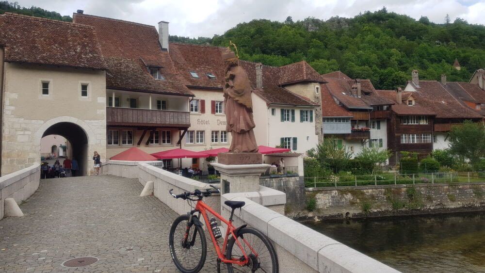
Don’t hesitate, continue on to the charming medieval village of Saint-Ursanne. Cross the Doubs on the stone bridge, pass under the tower, and you get to a pleasant cobbled square for a break. Because what follows is going to be harder (what you don’t know yet).
Mountains, frankly…
After an approach along the river, the route climbs steeply to reach the Franches-Montagnes plateau at an altitude of 1,000m. You’ll even pass through Les Enfers (The Hells), but don’t worry when you get there, the hard part’s over. Gravel paths and trails wind their way through forests and alpine pastures, and you’ll arrive in Saignelégier, the region’s little main town, with its imposing buildings, relics of the golden age of watchmaking.
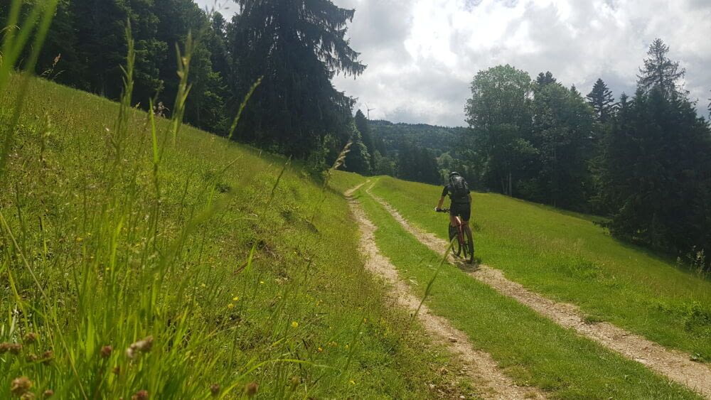
What follows is a feast for the eyes, as you wind your way through lush green marshes and fir-tree-fringed meadows, creating an enchanting atmosphere. Picturesque and typical, the Jura in all its splendor.
Mont-Soleil is home to Switzerland’s largest wind power station, and it’s at the foot of their nonchalant blades that you’ll continue across these magnificent plateaus, all the way to La Chaux-de-Fonds, the third-largest city in French-speaking Switzerland. A clear contrast to the calm and serenity of the landscape you’ve just crossed.
Let’s get out of town, quick.
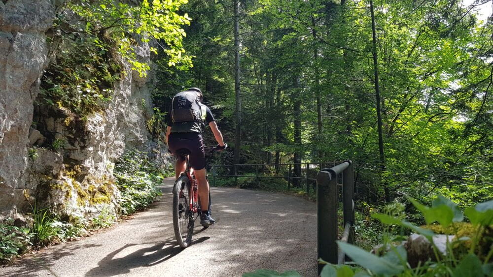
To return to a more peaceful atmosphere, you’ll need to climb the Grand-Crêt to Pouillerel (1,277m), before plunging back into the Doubs Gorges, through forest and even a few tunnels. Don’t forget to stop off at Saut-du-Doubs, the region’s most famous waterfall, and enjoy the scenery along the cliffs leading to Les Brenets.
Starting from Le Locle, it’s straight away quite steep, and a few singles tracks may force you to dismount your bike (as I did). But if you reach the summit of Grand Sommartel, at an altitude of 1,313 m, you’ll enjoy a pretty plateau, then a long descent to the village of Couvet, which I did in the rain.
There’s a short “false flat” descent along the Areuse into the Val de Travers, before tackling a long climb. But don’t worry, it’s not too steep and well worth the effort.
The big hollow
It takes you to an altitude of 1,420m (a climb of +686m), where I recommend you to leave the official itinerary and make a small detour towards “La Ferme du Soliat”, and from there continue up through the fields to the wall made of dry stones, pass it and go to the edge. The edge of what?
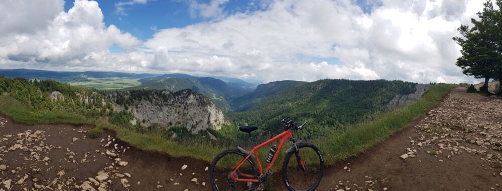
The edge of Le Creux (the Hole). Le Creux-du-Van is a magnificent rocky cirque (1400m wide, 200m high) at the top of whose cliffs you can admire a superb panorama, while enjoying the dried meat sandwich you’ve taken out of your bag. There is no better spot for a luncheon.
The big screen
The rest is a little quieter, with high plateaus at a more or less constant altitude, fir trees, cows, more or less technical but not steep singles tracks – to make a long story short, it’s a mountain biker’s pleasure. And when you arrive above Bullet, you’ll be amazed by the incredible panorama of almost the whole of French-speaking Switzerland. Yes, yes: Lake Neuchâtel at your feet, the whole canton of Vaud, and a good part of Fribourg, the Alps in the background, then the Alps, the Dents-du-Midi Mountains (home, in Valais, at the foot of which I took the train to get to Basel), Lake Geneva, and behind that, Le Mont-Blanc. The whole map on a panoramic screen.
A few more kilometers, and you’re in Sainte-Croix. An astonishing little town lost in the mountains, with massive buildings reflecting a prosperous watchmaking history.
You have to get out of the valley, but the climb isn’t too steep, and if you look left, you’ll be able to enjoy the panorama for several kilometers.
All the way up to the foot of the Aiguilles de Baulmes mountain, where among the alpine pastures and cows, you’ll see the first bunkers, remnants of the defense lines built during the Second World War. You’ll even see a Toblerone. Not the chocolate, but those long lines of anti-tank concrete triangles, which you come across quite often in Switzerland, when close to borders.
The descent to Vallorbe is magnificent, through mountain pastures and fir trees, before climbing back up through the forest to Lac de Joux.
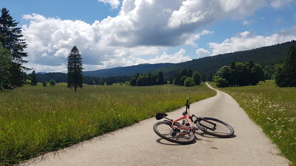
It’s time to enjoy a few kilometers of “flat” along the lake, through a forest that is nonetheless very stony, all the way to Le Sentier.
A last effort for a last amazing moment
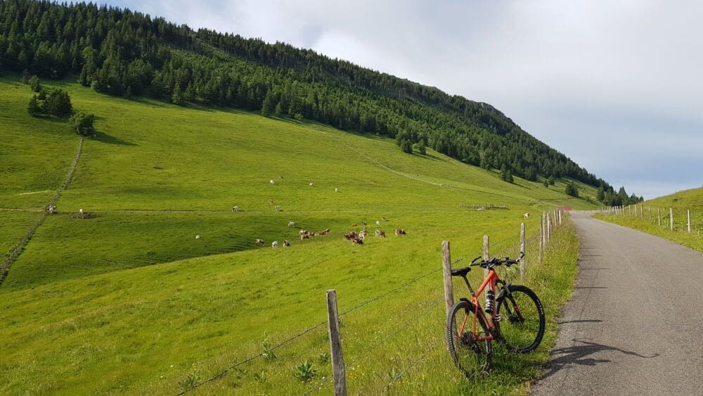
Shortly afterwards, you’ll have to climb and cross the last mountain of this journey, a beautiful climb that takes you to an altitude of over 1,300m, where you enjoy magnificent alpine meadows, more or less flat, where you’ll meander with huge pleasure between fir trees and cows, all the way to the highest point of the trip, the Col du Marchairuz, elevation 1,449m.
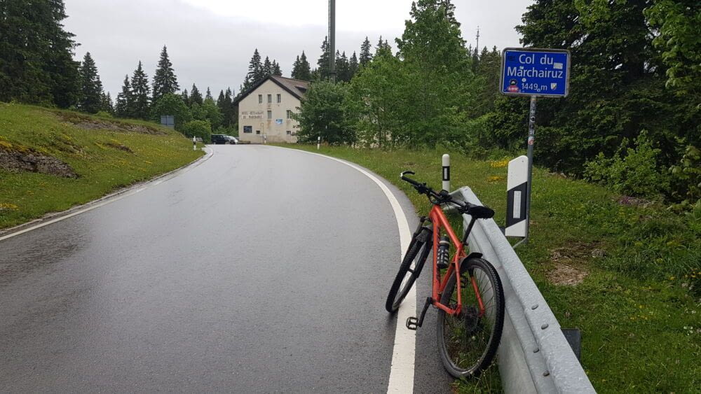
The descent starts with a nice single track, but quite technical as it’s wet from rain, then long traverses along stone walls, or through thick forests, until you’re back on tarmac, near Bassins.
Then all you have to do is glide down to the shores of Lake Geneva. And here you are in Nyon.
You’ve made it, you’ve crossed the Swiss Jura, crossed the whole Switzerland along western border on the strength of your calves.
Do you want to do it? You can do it !
Don’t hesitate. Straddle any bike, pedal, and you’ll get a real kick out of it, but more importantly, a real eyeful.
Détails, and other tips
375km / 9400m D+ / 5 days
Done in 5 stages (SuisseMobile suggests 9 stages)
1. Bâle – Delémont : 75km / +1'715m
2. Delémont – Saignelégier : 70.5km / + 1'619m
3. Saignelégier – Le Locle : 68.3km / +1'390m
4. Le Locle – Saint-Croix : 69km / +1'791m
5. Saint-Croix – Nyon : 92.7km / +1'899m
Natural path, about. 170km / singletrail, about. 30km / tarmac about 190km
The whole route : 5 .GPX files to download here (available soon)
Don’t miss any fountain, fill up your bottle (even if almost full), you’ll be thirsty
You can do it on an e-bike, but you may need to adapt stages, according to your battery,
No hike-a-bike, but I had to push a feww times, briefly, in front of climbs (or descents) to steep or ticky for me.